
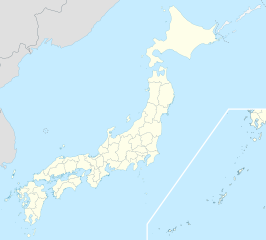
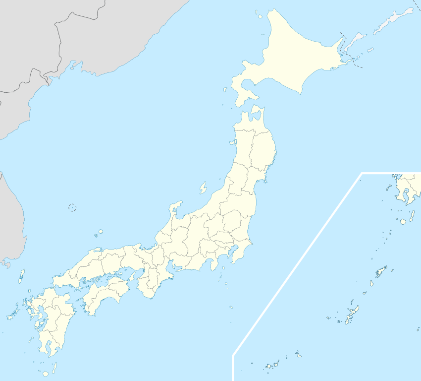
ဖိုင်:Japan location map with side map of the Ryukyu Islands.svg

မူရင်းဖိုင် (SVG ဖိုင်, ၄၁၃ × ၃၇၃ pixels ကို အကြံပြုသည်, ဖိုင်အရွယ်အစား - ၉၈၀ KB)
| ဤဖိုင်သည် Wikimedia Commons မှဖြစ်ပြီး အခြားပရောဂျက်များတွင် သုံးကောင်းသုံးလိမ့်မည်။ ယင်း၏ ဖိုင်အကြောင်းစာမျက်နှာ တွင် ဖော်ပြထားချက်ကို အောက်တွင် ပြထားသည်။ Commons သည် မူပိုင်ခွင့်လွတ်လပ်သော မီဒီယာဖိုင်များ သိုလှောင်ထားရာ နေရာ ဖြစ်သည်။ သင်လည်း ပါဝင်ကူညီနိုင်ပါသည်။ |
အကျဉ်းချုပ်
| ဖော်ပြချက် |
Deutsch: Postionskarte von Japan
Quadratische Plattkarte. Bei Nutzung der Hauptkarte mit den Hauptinseln gelten folgende geographische Begrenzungen für die (Gesamt-)Karte:
Bei Nutzung der Nebenkarte mit den Ryūkyū-Inseln gelten folgende geographische Begrenzungen für die (Gesamt-)Karte:
English: Location map of Japan
Equirectangular projection. Geographic limits to locate objects in the main map with the main islands:
Geographic limits to locate objects in the side map with the Ryukyu Islands:
日本語: 日本国の地図。
正距円筒図法。 南西諸島以外の日本を描いたメインの地図が示す領域:
南西諸島を描いた右下の地図が示す領域:
|
||
| ရက်စွဲ | |||
| ရင်းမြစ် | ကိုယ်ပိုင်ဖန်တီးမှု | ||
| စာရေးသူ | Maximilian Dörrbecker (Chumwa) | ||
| ခွင့်ပြုချက် (ဤဖိုင်ကို ပြန်လည်အသုံးပြုခြင်း) |
ကျွန်ုပ်၊ ဤလုပ်ဆောင်ချက်၏ မူပိုင်ခွင့်ပိုင်ရှင်အနေဖြင့် ဤနေရာမှ အောက်ပါလိုင်စင်များအောက်တွင် ထုတ်လွှင့်ပါသည်:
ဤဖိုင်ကို Creative Commons Attribution-Share Alike 3.0 Unported လိုင်စင်ဖြင့် သတ်မှတ်ထားသည်။
သင်အလိုရှိရာ လိုင်စင်ကို ရွေးချယ်နိုင်ပါသည်။ |
||
| အခြား ဗားရှင်းများ |
Derivative works of this file: |
||
| SVG genesis | ဤ SVG ၏ ကုဒ်သည် ခိုင်လုံသည်။ This map was created with Adobe Illustrator.
|


ဖိုင်မှတ်တမ်း
ဖိုင်ကို ယင်းနေ့စွဲ အတိုင်း မြင်နိုင်ရန် နေ့စွဲ/အချိန် တစ်ခုခုပေါ်တွင် ကလစ်နှိပ်ပါ။
| နေ့စွဲ/အချိန် | နမူနာပုံငယ် | မှတ်တမ်း ဒိုင်မန်းရှင်းများ | အသုံးပြုသူ | မှတ်ချက် | |
|---|---|---|---|---|---|
| ကာလပေါ် | ၁၄:၂၁၊ ၃ ဧပြီ ၂၀၂၂ | | ၄၁၃ × ၃၇၃ (၉၈၀ KB) | Peka | Reverted to version as of 10:18, 10 August 2021; no discuss about this change |
| ၁၀:၁၈၊ ၁၀ ဩဂုတ် ၂၀၂၁ |  | ၄၁၃ × ၃၇၃ (၁.၅၆ MB) | 호로조 | Liancourts Rock isn't territory of Japan | |
| ၀၅:၁၉၊ ၁၄ နိုဝင်ဘာ ၂၀၂၀ |  | ၄၁၃ × ၃၇၃ (၉၈၀ KB) | AichiWikiFixer | Fix borders. | |
| ၁၃:၅၃၊ ၃၀ အောက်တိုဘာ ၂၀၁၀ |  | ၄၁၃ × ၃၇၃ (၉၂၆ KB) | NordNordWest | Liancourts Rock boundary | |
| ၀၁:၁၅၊ ၁၇ စက်တင်ဘာ ၂၀၁၀ |  | ၄၁၃ × ၃၇၃ (၁.၅၆ MB) | Dinamik | medium color for disputed territories | |
| ၁၁:၄၁၊ ၂၁ မတ် ၂၀၁၀ |  | ၄၁၃ × ၃၇၃ (၁.၅၂ MB) | Chumwa | Präfekturgrenzen bereinigt | |
| ၁၃:၃၃၊ ၂၀ မတ် ၂၀၁၀ |  | ၄၁၃ × ၃၇၃ (၁.၇၁ MB) | Chumwa | Trennlinie zu Nebenkarte etwas verbreitert | |
| ၀၉:၅၀၊ ၂၀ မတ် ၂၀၁၀ |  | ၄၁၃ × ၃၇၃ (၁.၉၂ MB) | Chumwa | == {{int:filedesc}} == {{Information |Description= {{de|Postionskarte von Japan}} Quadratische Plattkarte. Bei Nutzung der Hauptkarte mit den Hauptinseln gelten folgende geographische Begrenzungen für die (Gesamt-)Karte: * N: 45°51'37" N |
ဖိုင်သုံးစွဲမှု
ဤဖိုင်သို့ စာမျက်နှာများ ၁၀၀ ခုထက်မက အသုံးပြုထားသည်။ အောက်ပါစာရင်းသည် ဤဖိုင်တစ်ခုတည်းကိုသာ အသုံးပြုထားသော ပထမဆုံး ၁၀၀ စာမျက်နှာများကိုသာ ပြသထားသည်။ စာရင်းအပြည့်အစုံလည်း ရရှိနိုင်ပါသည်။
- ခနိအဲမြို့၊ အအိချိ
- ခနဲယာမမြို့၊ ဖူကူရှီးမား
- ခန်နမြို့၊ ဂွန်းမ
- ခန်ရမြို့၊ ဂွန်းမ
- ခမိဆုနာဂါဝါ၊ ဟော့ကိုင်းဒိုး
- ခါဂါမီးရှိမြို့၊ ဖူကူရှီးမား
- ခါဝါမာတာမြို့၊ ဖူကူရှီးမား
- ခိဟိုခုမြို့၊ မိအဲ
- ခိုဆာခါမြို့၊ အခိတ
- ခိုအိုရိမြို့၊ ဖူကူရှီးမား
- ခုဆဆွတ်မြို့၊ ဂွန်းမ
- ခုနိမိမြို့၊ ဖူကူရှီးမား
- ခုရိယာမမြို့၊ ဟော့ကိုင်းဒိုး
- ချစ်ပုဘဲဆွတ်မြို့၊ ဟော့ကိုင်းဒိုး
- ဂေါ့ဂျေားမဲမြို့၊ အခိတ
- ဆခအဲမြို့၊ ချိဘ
- ဆတ်ဆွတ်မြို့၊ ဟော့ကိုင်းဒိုး
- ဆန်နိုဟဲမြို့၊ အအိုမိုရိ
- ဆိုတိုဂါဟာမမြို့၊ အအိုမိုရိ
- ဆွတ်ခိဂတမြို့၊ ဟော့ကိုင်းဒိုး
- ဆွတ်ရုတမြို့၊ အအိုမိုရိ
- တက်ခိုမြို့၊ အအိုမိုရိ
- တခဟမမြို့၊ ဖုခုအိ
- တခအိုခ၊ တိုယာမ
- တခိုမြို့၊ ချိဘ
- တာဒမိမြို့၊ ဖူကူရှီးမား
- တာနဂုရမြို့၊ ဖူကူရှီးမား
- တိုမိအိုခမြို့၊ ဖူကူရှီးမား
- တိုးဟိုခုမြို့၊ အအိုမိုရိ
- နန်ပိုရိုမြို့၊ ဟော့ကိုင်းဒိုး
- နန်ဘုမြို့၊ အအိုမိုရိ
- နမိအဲမြို့၊ ဖူကူရှီးမား
- နာဂါနုမမြို့၊ ဟော့ကိုင်းဒိုး
- နာဂါရမြို့၊ ချိဘ
- နာဂိုယာမြို့
- နာရာဟမြို့၊ ဖူကူရှီးမား
- နာရိတ အပြည်ပြည်ဆိုင်ရာ လေဆိပ်
- နိရှိအအိဇုမြို့၊ ဖူကူရှီးမား
- နိုင်းအဲမြို့၊ ဟော့ကိုင်းဒိုး
- ဖုခအုရမြို့၊ အအိုမိုရိ
- ဖုဂျိဆတိုမြို့၊ အခိတ
- ဖုဂျိဆာခိမြို့၊ အအိုမိုရိ
- ဖုဘတမြို့၊ ဖူကူရှီးမား
- ဖုရုဒိုနိုမြို့၊ ဖူကူရှီးမား
- ဘန်ဒိုင်းမြို့၊ ဖူကူရှီးမား
- ဘိဖုခမြို့၊ ဟော့ကိုင်းဒိုး
- ဘိရတိုရိမြို့၊ ဟော့ကိုင်းဒိုး
- ဘိဟိုရိုမြို့၊ ဟော့ကိုင်းဒိုး
- ဘိအဲအိမြို့၊ ဟော့ကိုင်းဒိုး
- ဘဲဆွတ်ခိုင်၊ ဟော့ကိုင်းဒိုး
- မိခဝမြို့၊ ယာမာဂါတ
- မိဆတိုမြို့၊ အခိတ
- မိတနဲမြို့၊ အခိတ
- မိနမိအဲချိဇန်းမြို့၊ ဖုခုအိ
- မိရှိမမြို့၊ ဖူကူရှီးမား
- မိဟမမြို့၊ ဖုခုအိ
- မိဟရုမြို့၊ ဖူကူရှီးမား
- ယနိုင်းဇုမြို့၊ ဖူကူရှီးမား
- ယဘုခိမြို့၊ ဖူကူရှီးမား
- ယဝတမြို့
- ယာမဆွတ်ရိမြို့၊ ဖူကူရှီးမား
- ယိုကိုဟားမားမြို့
- ရိုခုနိုဟဲမြို့၊ အအိုမိုရိ
- ရှင်းချိမြို့၊ ဖူကူရှီးမား
- ရှင်းတိုဆွတ်ခါဝါမြို့၊ ဟော့ကိုင်းဒိုး
- ရှိချိနိုဟဲမြို့၊ အအိုမိုရိ
- ရှိဘယာမမြို့၊ ချိဘ
- ရှိမိုဂိုးမြို့၊ ဖူကူရှီးမား
- ဝါခါဆာမြို့၊ ဖုခုအိ
- ဟချိရေားဂတမြို့၊ အခိတ
- ဟပ်ပိုးမြို့၊ အခိတ
- ဟာနာဝါမြို့၊ ဖူကူရှီးမား
- ဟာနဲ့ဒါ့ လေဆိပ်
- ဟီရိုရှီးမားမြို့
- အက်ခဲရှိမြို့၊ ဟော့ကိုင်းဒိုး
- အဂျိဂါဆာဝါမြို့၊ အအိုမိုရိ
- အင်းဂါရုမြို့၊ ဟော့ကိုင်းဒိုး
- အင်းဘဲဆွတ်မြို့၊ ဟော့ကိုင်းဒိုး
- အဆွတ်မမြို့၊ ဟော့ကိုင်းဒိုး
- အဘိရမြို့၊ ဟော့ကိုင်းဒိုး
- အရှောရိုမြို့၊ ဟော့ကိုင်းဒိုး
- အအိဘဲဆွတ်မြို့၊ ဟော့ကိုင်းဒိုး
- အာဆာခါဝါမြို့၊ ဖူကူရှီးမား
- အိခါဝါမြို့၊ အခိတ
- အိခဲဒမြို့၊ ဖုခုအိ
- အိချိနိုမိယာမြို့၊ ချိဘ
- အိတာယာနာဂိမြို့၊ အအိုမိုရိ
- အိမဘဲဆွတ်မြို့၊ အအိုမိုရိ
- အိရှိခါဝါမြို့၊ ဖူကူရှီးမား
- အိုအိရဆဲမြို့၊ အအိုမိုရိ
- အိုးခုမမြို့၊ ဖူကူရှီးမား
- အိုးတခိမြို့၊ ချိဘ
- အိုးမမြို့၊ အအိုမိုရိ
- အိုးဝနိမြို့၊ အအိုမိုရိ
- အိုးအိမြို့၊ ဖုခုအိ
- အုဂိုမြို့၊ အခိတ
- အုရအုဆုမြို့၊ ဟော့ကိုင်းဒိုး
- အဲချိဇန်းမြို့၊ ဖုခုအိ
- အဲဆရှိမြို့၊ ဟော့ကိုင်းဒိုး (ဟိယာမ)
- အဲရိမိုမြို့၊ ဟော့ကိုင်းဒိုး
ဤဖိုင်သို့နောက်ထပ်လင့်များ ကိုကြည့်ပါ။
ဂလိုဘယ် ဖိုင်သုံးစွဲမှု
အောက်ပါ အခြားဝီကီများတွင် ဤဖိုင်ကို အသုံးပြုထားသည်-
- ace.wikipedia.org တွင် အသုံးပြုမှု
- af.wikipedia.org တွင် အသုံးပြုမှု
- Osaka
- Hirosjima
- Tokio
- Nara, Nara
- Kioto
- Nagasaki
- Jokohama
- Nagoja
- Sapporo
- Kobe
- Nagano
- FIFA Sokker-Konfederasiebeker in 2001
- Nanao
- Rugbywêreldbeker 2019
- Fukuoka
- Kawasaki
- Saitama
- Sendai
- Kitakyushu
- Chiba
- Tokio-Haneda Internasionale Lughawe
- Narita Internasionale Lughawe
- Kansai Internasionale Lughawe
- Toyota, Aichi
- Groep van Sewe
- Saga (stad)
- als.wikipedia.org တွင် အသုံးပြုမှု
- an.wikipedia.org တွင် အသုံးပြုမှု
- ar.wikipedia.org တွင် အသုံးပြုမှု
ဤဖိုင်ကို အခြားနေရာများတွင် အသုံးပြုထားမှုများအား ကြည့်ရှုရန်။