
ဖိုင်:Africa-asia-america-to-scale.jpg
ဤနမူနာ၏ အရွယ်အစား - ၈၀၀ × ၂၆၇ ပစ်ဇယ်။ အခြား ပုံရိပ်ပြတ်သားမှု: ၃၂၀ × ၁၀၇ ပစ်ဇယ် | ၁၂၀၀ × ၄၀၀ ပစ်ဇယ်။
မူရင်းဖိုင် (၁၂၀၀ × ၄၀၀ pixels, ဖိုင်အရွယ်အစား - ၂၂၃ KB, MIME အမျိုးအစား image/jpeg)
| ဤဖိုင်သည် Wikimedia Commons မှဖြစ်ပြီး အခြားပရောဂျက်များတွင် သုံးကောင်းသုံးလိမ့်မည်။ ယင်း၏ ဖိုင်အကြောင်းစာမျက်နှာ တွင် ဖော်ပြထားချက်ကို အောက်တွင် ပြထားသည်။ Commons သည် မူပိုင်ခွင့်လွတ်လပ်သော မီဒီယာဖိုင်များ သိုလှောင်ထားရာ နေရာ ဖြစ်သည်။ သင်လည်း ပါဝင်ကူညီနိုင်ပါသည်။ |
| ဖော်ပြချက် |
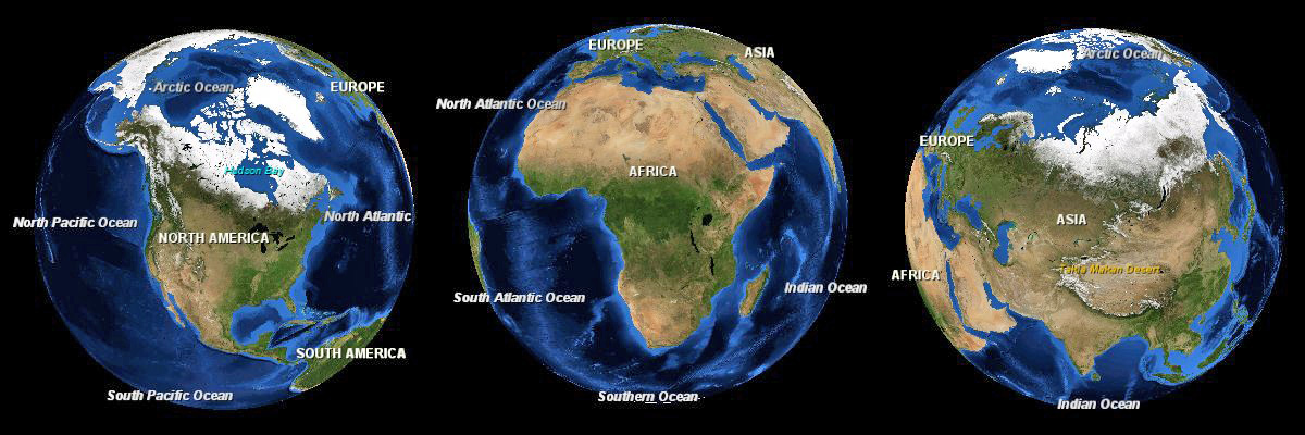
English: Three images of the Earth showing North America, Africa and Eurasia to scale. |
|||
| ရက်စွဲ | ||||
| ရင်းမြစ် | NASA World Wind | |||
| စာရေးသူ | Andrew Oakley | |||
| ခွင့်ပြုချက် (ဤဖိုင်ကို ပြန်လည်အသုံးပြုခြင်း) |
|

ဖိုင်မှတ်တမ်း
ဖိုင်ကို ယင်းနေ့စွဲ အတိုင်း မြင်နိုင်ရန် နေ့စွဲ/အချိန် တစ်ခုခုပေါ်တွင် ကလစ်နှိပ်ပါ။
| နေ့စွဲ/အချိန် | နမူနာပုံငယ် | မှတ်တမ်း ဒိုင်မန်းရှင်းများ | အသုံးပြုသူ | မှတ်ချက် | |
|---|---|---|---|---|---|
| ကာလပေါ် | ၂၀:၅၇၊ ၄ ဇန်နဝါရီ ၂၀၁၂ | ၁၂၀၀ × ၄၀၀ (၂၂၃ KB) | Soerfm | Brightness | |
| ၁၃:၅၃၊ ၁၃ အောက်တိုဘာ ၂၀၀၈ | ၁၂၀၀ × ၄၀၀ (၁၀၃ KB) | Evilandi | {{Information |Description={{en|1=Three images of the Earth showing North America, Africa and Asia to scale.}} |Source=NASA World Wind |Author=Andrew Oakley |Date=2008-10-13 |Permission={{PD-WorldWind}} |other_versions= }} <!--{{ImageUpload|full}}--> |
ဖိုင်သုံးစွဲမှု
အောက်ပါ စာမျက်နှာ သည် ဤဖိုင်ကို အသုံးပြုထားသည်:
ဂလိုဘယ် ဖိုင်သုံးစွဲမှု
အောက်ပါ အခြားဝီကီများတွင် ဤဖိုင်ကို အသုံးပြုထားသည်-
- gl.wikipedia.org တွင် အသုံးပြုမှု
- it.wikipedia.org တွင် အသုံးပြုမှု
- os.wikipedia.org တွင် အသုံးပြုမှု
- sa.wikipedia.org တွင် အသုံးပြုမှု
- sd.wikipedia.org တွင် အသုံးပြုမှု
- sw.wikipedia.org တွင် အသုံးပြုမှု
- tr.wikipedia.org တွင် အသုံးပြုမှု