
ဖိုင်:BlankEurope.png

ဤနမူနာ၏ အရွယ်အစား - ၅၉၅ × ၅၉၉ ပစ်ဇယ်။ အခြား ပုံရိပ်ပြတ်သားမှု: ၂၃၈ × ၂၄၀ ပစ်ဇယ် | ၄၇၇ × ၄၈၀ ပစ်ဇယ် | ၇၆၂ × ၇၆၈ ပစ်ဇယ် | ၁၂၃၆ × ၁၂၄၅ ပစ်ဇယ်။
မူရင်းဖိုင် (၁၂၃၆ × ၁၂၄၅ pixels, ဖိုင်အရွယ်အစား - ၇၈ KB, MIME အမျိုးအစား image/png)
| ဤဖိုင်သည် Wikimedia Commons မှဖြစ်ပြီး အခြားပရောဂျက်များတွင် သုံးကောင်းသုံးလိမ့်မည်။ ယင်း၏ ဖိုင်အကြောင်းစာမျက်နှာ တွင် ဖော်ပြထားချက်ကို အောက်တွင် ပြထားသည်။ Commons သည် မူပိုင်ခွင့်လွတ်လပ်သော မီဒီယာဖိုင်များ သိုလှောင်ထားရာ နေရာ ဖြစ်သည်။ သင်လည်း ပါဝင်ကူညီနိုင်ပါသည်။ |

|
File:Blank map of Europe (with disputed regions).svg is a vector version of this file. It should be used in place of this PNG file when not inferior.
File:BlankEurope.png → File:Blank map of Europe (with disputed regions).svg
For more information, see Help:SVG. |
.svg) |
အကျဉ်းချုပ်
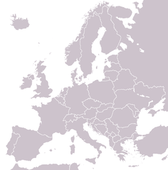
A blank political map of Europe extracted from Image:European Union member states by number of houses.png. +Hexagon1 (t) 04:47, 26 November 2006 (UTC)
Other versions: if you wish to use a map to show historical information before 2008, use Image:BlankEurope-BeforeKosovo.png
လိုင်စင်သတ်မှတ်ခြင်း

|
ဤစာတမ်းကို GNU Free Documentation License, ဗားရှင်း ၁.၂ သို့မဟုတ် Free Software Foundation မှ ဖြန့်ချီထားသော မည်သည့်ယခင်ဗားရှင်းတစ်ခုခုအောက်တွင် Invariant Sections, Front-Cover Texts နှင့် Back-Cover Texts များမပါဝင်ဘဲ ကူးယူခြင်း၊ ဖြန့်ချီခြင်း နှင့်/သို့မဟုတ် ပြင်ဆင်ပြောင်းလဲနိုင်ရန် ခွင့်ပြုသည်။ လိုင်စင်မူပွားကို GNU Free Documentation License ခေါင်းစဉ်အောက်တွင် ထည့်သွင်းထားသည်။ |
| ဤဖိုင်ကို Creative Commons Attribution-Share Alike 3.0 Unported လိုင်စင်ဖြင့် သတ်မှတ်ထားသည်။ | ||
| ||
| This licensing tag was added to this file as part of the GFDL licensing update. |
ဖိုင်မှတ်တမ်း
ဖိုင်ကို ယင်းနေ့စွဲ အတိုင်း မြင်နိုင်ရန် နေ့စွဲ/အချိန် တစ်ခုခုပေါ်တွင် ကလစ်နှိပ်ပါ။
| နေ့စွဲ/အချိန် | နမူနာပုံငယ် | မှတ်တမ်း ဒိုင်မန်းရှင်းများ | အသုံးပြုသူ | မှတ်ချက် | |
|---|---|---|---|---|---|
| ကာလပေါ် | ၁၃:၃၁၊ ၂၆ စက်တင်ဘာ ၂၀၂၂ | | ၁၂၃၆ × ၁၂၄၅ (၇၈ KB) | BlackShadowG | Reverted to version as of 14:55, 27 October 2008 (UTC) |
| ၂၂:၄၀၊ ၂၃ ဖေဖော်ဝါရီ ၂၀၀၉ |  | ၁၂၃၆ × ၁၂၄၅ (၇၈ KB) | Avala | ||
| ၁၄:၅၅၊ ၂၇ အောက်တိုဘာ ၂၀၀၈ |  | ၁၂၃၆ × ၁၂၄၅ (၇၈ KB) | Quilbert | Reverted to version as of 05:53, 5 April 2008 – there is already Image:BlankEurope-BeforeKosovo.png | |
| ၁၈:၁၃၊ ၂၄ အောက်တိုဘာ ၂၀၀၈ |  | ၁၂၃၆ × ၁၂၄၅ (၇၈ KB) | Avala | ||
| ၀၅:၅၃၊ ၅ ဧပြီ ၂၀၀၈ |  | ၁၂၃၆ × ၁၂၄၅ (၇၈ KB) | Hoshie | redid microstates, beefed up Spanish N. Africa, SBAs, and Gibraltar | |
| ၁၈:၄၂၊ ၂၅ ဖေဖော်ဝါရီ ၂၀၀၈ |  | ၁၂၃၆ × ၁၂၄၅ (၇၈ KB) | Hoshie | fixed Gibraltar, Ceuta and Melilla, and the SBAs | |
| ၀၂:၃၉၊ ၂၄ ဖေဖော်ဝါရီ ၂၀၀၈ |  | ၁၂၃၆ × ၁၂၄၅ (၇၈ KB) | Hoshie | Added Kosovo since it has been internationally recognized | |
| ၂၂:၄၀၊ ၃ ဇန်နဝါရီ ၂၀၀၈ |  | ၁၂၃၆ × ၁၂၄၅ (၇၈ KB) | Hoshie | Re-drew ESBA and WSBA with circles until I study the CIA maps, boundary between Gibraltar and Spain. | |
| ၀၄:၄၇၊ ၂၆ နိုဝင်ဘာ ၂၀၀၆ |  | ၁၂၃၆ × ၁၂၄၅ (၄၄ KB) | Happenstance | A blank map of Europe extracted from Image:European Union member states by number of houses.png. ~~~~ |
ဖိုင်သုံးစွဲမှု
ဤဖိုင်ကို အသုံးပြုထားသော စာမျက်နှာများမရှိပါ။
ဂလိုဘယ် ဖိုင်သုံးစွဲမှု
အောက်ပါ အခြားဝီကီများတွင် ဤဖိုင်ကို အသုံးပြုထားသည်-
- de.wiktionary.org တွင် အသုံးပြုမှု
- hu.wikipedia.org တွင် အသုံးပြုမှု
- incubator.wikimedia.org တွင် အသုံးပြုမှု
- it.wiktionary.org တွင် အသုံးပြုမှု
- sl.wiktionary.org တွင် အသုံးပြုမှု
- uk.wikipedia.org တွင် အသုံးပြုမှု